

- Meteo
- WebCam
-
 La Val di Sole vista da WEB DESIGNER
 -
 Pellizzano visto da HOTEL PEZZOTTI
 -
 Il Passo Tonale visto da HOTEL LA TORRETTA
 -
 La Presanella vista da HOTEL CHALET AL FOSS
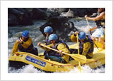
Rafting and Canoeing
 The Noce River springs at the Corno dei Tre Signori (3360 m), in the Ortles-Cevedale Range, and after a few kilometres it forms the artificial lake of Pian Palù in the upper Val di Peio. Reduced to a brook by hydroelectric drawings, it flows to Cogolo, where it meets the waters of the Noce Bianco.
After around three kilometres from Cogolo, the Noce river plunges into the valley forming uninterrupted rapids, calming down before it runs into the Vermigliana torrent, which springs at the Passo del Tonale.
The Noce river is one of the most interesting kayaking course of Italy, navigable for a length of nearly 30 Km, has alternatively stretches accessible to experts and others with minor difficulties, suitable also for those who like to initiate this exciting sporting activity like rafting and kayaking.
www.valdisole.it | www.hotelfolgarida.net | www.valdisolehotel.com | www.hotelmarilleva.com | www.valdinon.it | www.valdisolebooking.it
www.passotonale.it | www.hotelfoppolo.com
Copyright 1998-2012 - Web Designer - Trento - PIVA 01619460221